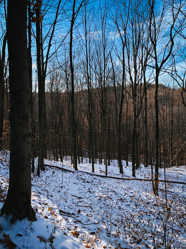
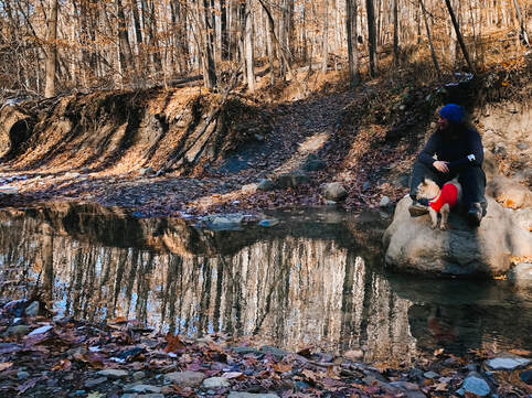
 This past weekend, Lucy and I took to the wide-open road and drove about an hour out to Ravenna to try a new portion of the Buckeye Trail – the West Branch Loop – which looped around the Michael J. Kirwan Reservoir. It was a lovely trail, for the most part, and really challenging! It took just about six hours for us to complete it (we stopped for lunch partway through for a half hour), and I’m glad I had my headlamp. It was completely dark by the time we got back to the car. Read on to find out why and to check out all the pics! Details: -Length: 9.4 miles -Elevation: 535 ft. The Good: -It had some very beautiful spots, really gorgeous. I bet it’s awesome in summer! -It was remote – I didn’t see anyone else on the trail, and for most of it couldn’t hear any cars, etc. -Enough of a challenge to make it interesting The Bad: -Because it doesn’t seem to be traversed often, you really gotta keep your eyes open for the Buckeye Trail blue blazes that are painted on the trees. Some are faded, and some are spread a little far apart. I didn’t have any issues and didn’t have to backtrack at all, but you DO really need to watch. I *did* check my AllTrails App a couple of times, just to be sure I was on the right path. -Remember how I mentioned it was a really challenging hike? That’s because the first half of it was definitely in a state of thawing mud – I’ve never been on a trail like that before – where the mud took on this half frozen weirdly inflated feel. So basically every time I stepped my foot went down and in different directions. Not sure how else to describe it, but it made for slow going and really sore feet the next day. So hiker, beware! May want to wait until it’s dried out a bit more. The Ugly: -Holy crap – there are two places, at either end of the loop, where you have to walk on the road for a little bit. Fairly common with the BT.
1 Comment
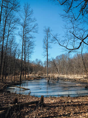
 This is from my first real winter hike of 2020, where the ground was frozen, the air crisp, the sky clear, and the beauty was REAL. I doubt I would have given this trail a try, if I hadn't strained a muscle and needed something a bit more on the chill side. Normally, I much prefer loop trails – I’ve found I really dislike retracing my steps on a hike. While I’ve found I can do the same loop over and over, covering the same ground in the same day makes the hike feel MUCH longer to me. I’m very glad I got the opportunity to hike this trail – it’s very pretty and removed from the road for the most part. It’s shorter – 3.3 miles – without much elevation, so it’s ideal for those just starting out, folks with minor injuries, or if you just want a quick out and about. They called it a “primitive trail,” which meant it narrowed to single file in sections, but was otherwise well maintained and very easy to follow/well marked.
Here’s all the pertinent details: · Loop Trail · 3.3 Miles · 308 Ft. Elevation · Dogs Allowed: Yes · Wheelchair Accessible: No Positives · I didn’t see anyone else on the trail, despite the “moderately trafficked” rating on AllTrails. My guess is it’s fairly deserted in winter. · It’s very pretty in spots, with several minor creek crossings. · There’s an archery range at the trailhead, be kind of neat to do both in a day! (note: have to bring your own bow/arrows, but it’s free and open to the public) Negatives · The “Top of the World” was a bit confusing. I went the little extra bit to check it out, and truthfully, I didn’t think the view was all that – it was pretty, but nothing really out of the ordinary. · It’s 3.3 miles – a very pretty hike, but the downside is that this loop doesn’t connect to any other trails in Cuyahoga Valley National Park, so there isn’t really an option to extend your hike if you want to. Have you hiked Adams Run? Have a trail recommendation? Let me know below or email me here! 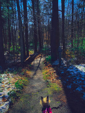
Little Dog, Big World.
 Lucy pondering how McDonalds is life. Lucy pondering how McDonalds is life.
This past weekend, Lucy and I decided to do an adventure of (semi)-epic proportions. So we donned our gear, grabbed some food to take with (McDonalds, don't judge, Lucy has a very refined pallet) and drove down to Cuyahoga Valley National Park to check out a- supposedly- 5.5 mile loop comprised of three separate trails - Perkins, Riding, and Furnace.
But it wasn't 5.5 miles - it was nearly 8. And TOUGH. SURPRISE B! I'm always surprised by what my body is capable of, which apparently is some big ass hills. Read on to get the scoop on the trail and all about our adventure! 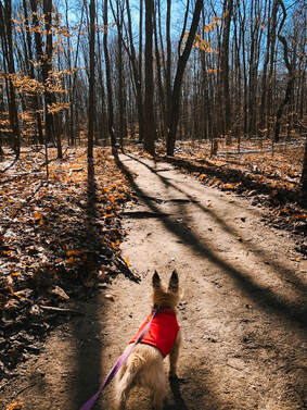 Lucy pondering why there aren't any leaves. Lucy pondering why there aren't any leaves.
The entire trail was beautiful - really lovely - with a lot of changing scenery. If you're up for a good challenge, I'd highly recommend it.
To start, Perkins - just magical, with moss covered trees and glinting light. The weird? SOMEONE CAME THROUGH AND LEAF BLEW THE TRAIL. I was super confused. It made the trail seem weird and unnatural. And privileged in a way that made me uncomfortable. I'll talk more about this in another post. All three trails had a LOT of elevation (three and a half near mountain limits of 1000ft.). The entire trip was basically "up/down up/down." Frankly, I was surprised by how well I held up.
 The tree I used as a bridge. The tree I used as a bridge.
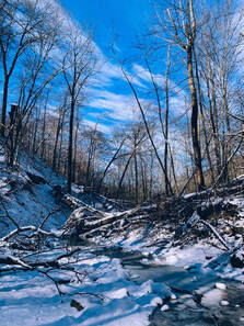
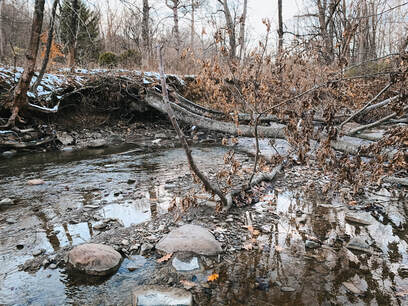
After heroically carrying Lucy through the briars, I wasn't going back through it. So I finally found a place to shimmy down. Then I had to cross - which I did by walking across a log. Even in winter, the water was knee high. I'm guessing even less passable in Spring.
I'm sure the rest of Furnace was pretty, though by the time I got through the creek I was beat, dusk was falling, and I still had 2 miles to go....SURPRISE....as I was already at 5 miles.
The last 1/2 mile of Furnace was comprised of dozens of stairs. Not great.
Wrap-Up: It was a real challenge, mainly due to the elevation and the distance I hadn't planned on. I felt *really* good about it at the end - my back held up with the pack. I'd definitely do Perkins and Riding again, but would dodge Furnace. Have you ever been surprised by the length of a hike? Or a trail "disappearing"? Comment below or contact me here. 
Charlie on the trail, much happier that I now use AllTrails.
One of the big problems getting started with outside adventuring has to do with access. Beginning hikers and walkers can find it difficult to determine if a trail they find online is appropriate to their ability, if they can even find trails around them. Once they find a trail, they want to know what the terrain is like and if there are any obstacles. Are trail bikes welcome? Horses? What about finding the trailhead? Navigating the trail? Any special wildlife areas they should be aware of, like bat habitats? Is it safe for their therapy or service animal?
I've had a number of folks the last few weeks ask what I use to gain access to the outside world, and my go to right now is AllTrails. Hands down, this is the best app I've found to give beginners - and experienced hikers - the access and information they need to get out in the outdoors. Six or seven years ago, I got lost on a Cleveland, OH trail. I had a printed map of the park, but the trails in the Metroparks aren't very well marked in most cases. It was cold and snowing. I had no cell reception and it was getting dark - of course I hadn't brought a headlamp/flashlight. The parks aren't all that big, so I knew I'd eventually find my way out. An hour after dark, my dog Charlie Chuckles and I made it back to the car. I was tired and reallllly pissed off.  It was really, REALLY cold. It was really, REALLY cold.
And this wasn't the first time I'd gotten turned around on the notoriously ill-marked trails in the Cleveland area. Or been unable to find a trailhead with sketchy directions from the internet. Then came AllTrails. Queue rescue-themed music. AllTrails has been wonderful, and really opened up my access to trails in the Cleveland, OH and surrounding areas. Trails I doubt I would have found, or had the courage to try, without it. AllTrails is awesome - You can select what you want out of a trail and search for it - distance from your home, dogs allowed, length of hike, trail bike accessibility, difficulty, etc. This makes it a great tool for folks with disabilities that need to know if a trail is paved, if there are amenities at the trail head, etc. A nice bonus is that you're able to read reviews and see pics of the trail - great way to check for mud or other problems like downed trees/washed out trails. And it's free. Hiking and outdoor adventuring is already prohibitively expensive for many, and anything that removes additional spending is great (pro-version is $2.50 a month, and gives you access to download/print different topo maps). You can use it to track yourself AND record your hike while on the trail, even when your phone is in airplane mode. AllTrails also has a directions option that will open your phone's GPS app and take you right to the trail head. This is A-mazing. Previously, I found myself constantly lost on back roads, and a few times I even gave up on the hike. As a new hiker finding remote trailheads was incredibly frustrating. It helps build confidence, since you can view nearly all the trails immediately around you, allowing you to add/shorten your hike as you want or need to. 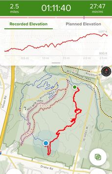
You can see where you've been, options to lengthen or shorten your hike/ride, and your pacing.
There are a couple downsides to AllTrails to keep in mind - it's not always 100% accurate in regards to length of the trail. I find the trails are often a half mile to a mile longer than indicated.
Keep in mind the difficulty rating of the trail tends to vary wildly. I did a 9 mile moderate trail last weekend, which was, to my surprise, easily and quickly accomplished even though it was pouring rain and I had to take a lot of breaks. Whereas I did a trail a few months ago that was five miles and very hilly, difficult terrain. Both were rated as moderate. I always encourage folks to have a printed map with them as well, and to understand how to read it, especially if you're in larger parks/national forests. Despite these issues, I recommend AllTrails for the access it provides. Have you ever gotten lost on the trail? Do you use an app or stick with a map, or both? Comment below, or feel free to contact me here! |
Archives
March 2021
Categories
All
|